Death Valley is a desert valley located in Eastern California. It is the lowest, driest, and hottest area in North America. Coordinates36°14′49″N 116°49′01″. Area 3,000 squares miles.
Death Valley's Badwater Basin is the point of the lowest elevation in North America, at 282 feet (86 m) below sea level. This point is 84.6 miles (136.2 km) east-southeast of Mount Whitney, the highest point in the contiguous United States with an elevation of 14,505 feet (4,421 m). Death Valley's Furnace Creek holds the record for the highest reliably recorded air temperature in the world, 134 °F (56.7 °C) on July 10, 1913.
Located near the border of California and Nevada, in the Great Basin, east of the Sierra Nevada mountains, Death Valley constitutes much of Death Valley National Park and is the principal feature of the Mojave and Colorado Deserts Biosphere Reserve. It is located mostly in Inyo County, California.
The highest point in Death Valley itself is Telescope Peak in the Panamint Range, which has an elevation of 11,043 feet (3,366 m).
The best observation point for the BadWater Basin and Salt Flats is Dantes view, elevation 5,000-ft/1524 m. above the floor of the Valley. You may drive to Dantes View 13 miles south of main road 139, entering from east side if the Valley. We saw only Badwater Basin with lard white spot in the center – Salt Flats. Telescope Peak was covered by fog. On the back way we saw many hills of Borax collected from borax mines around.
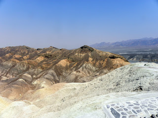
The most picture view in Death Valley is from Zabriskie Point, almost 360 degrees view of the beautiful mountains around. We left the car on the parking area and climbed by foot to the small hill to look around and take photos. All photos from the east entrance till Furnace Creak Inn (Dantes View, Zabriskie Point and around the roads) are shown in this album. The description and the photos from the rest part of the Death Valley are given in the next Death Valley 2 blog-album.


